Thursday, June 30, 2011

“Clouds Got in our Way”

Hard to believe, but it didn’t rain today (Wednesday). Instead it was cool and cloudy all morning, then cool and sunny by mid-afternoon. The newspaper says more rain is on its way, but today was fine for a 8 hour bus ride into the park.

Our bus
The reason this park exists is because of its wildlife, and people ride the buses in order to see them best. As a side note, there is a mountain (called Mt. McKinley) here but it is seen by visitors maybe 30% of the time. Today was not one of the 30%, but we did see a lot of critters: Grizzlies (some with babies), Caribou, Golden Eagle, Dall Sheep, ground squirrels, even a lone wolf. The only large animal we didn’t see was Moose, because they typically stay in thick willows and are hard to spot.  Here are some of the cariboy


The fifty miles of gravel road were in really good shape and had some dramatic views

Wednesday, June 29, 2011

To Denali National Park

Tuesday was a transit day.  We phoned Denali early in the morning from Fairbanks to place a reservation for 2 seats on a tour bus tomorrow.  Then we drove through constant fog and drizzle about 100 miles south of Fairbanks to the continent's largest mountain.  On a clear day, we might have seen the mountain on our way but not today. 
We were only able to see the foothills.
Yesterday we were told this area is a desert, but we must have got a month's worth of rain in the last 3 days.  It started again before dawn and kept up all day, not hard, just a constant drizzle with no sun and temps in the 50s.

We got to the park's Visitors Center early this afternoon and picked up our tickets for tomorrow.  They also had a couple of short videos and a pretty good museum for our afternoon's entertainment.  We're hoping that we'll be able to view Mt. McKinley tomorrow but the forecast looks like more rain.

Monday, June 27, 2011

Fairbanks Touristy Stuff – Day 2 (Monday)

Today was a mostly sunny day in the 80’s for the most part. We started out the day by visiting the Visitors Center in downtown Fairbanks. They had a ton of information and a very nice exhibit giving an overview of the history and geography of the area. We walked around the walking paths and visited the downtown also.


This afternoon we had reservations on a paddlewheel boat called the Discovery. This boat went down the Chena River to its end at the Tanana River.


This was a unique tour as the tour guide was able to communicate with the pilot of a sea plane/bush pilot who gave a demonstration on taking off and landing on the river right in front of us. Also, we were able to get a sled dog demonstration from Susan Butcher’s husband as we passed by their kennels. A group of 10 dogs bred for racing were hitched to a four wheel ATV which had no engine. The dogs pulled 600 pounds of ATV and rider around a trail for us. It was pretty interesting! Note all of the kennels in the fenced in area.  These are dogs being trained for pulling sleds.


When the boat got to the Tanana River, we disembarked at a re-enactment of a local fishing camp as it would have appeared many years ago. Some local Athabascan young women gave great presentations regarding the life of these people and how they survived.  This picture shows the young woman modeling a warm coat typical of those made by the women of the village.


We ended the day with a Salmon Bake at Pioneer Village. This is a sort of theme park with the history of this area. Then we walked through a local Market which was held down by the river which included some vendors and entertainment.

The narrator on our boat tour called this area a desert due to its limited precipitation (11.3 inches per year on the average). Winters are quite cold, but without much snow. Supposedly there is not much rainfall either, but we’ve seen light showers almost every day. Not a lot of rain, just enough to keep the dust down. The weather was great except for about a 1 hour shower as the boat returned to the dock. The sun came out again for the evening. We sure can’t complain about the weather here in Fairbanks! It’s been a great city to visit!

Question for the day - What is the difference between a reindeer and a caribou?

Sunday, June 26, 2011

Tourist Day in Fairbanks – Day 1

We started out our first tourist day in Fairbanks by attending a Methodist Church near the downtown. They are between ministers but the lay people did a great job and they were very welcoming. There was another visiting couple from Owatonna, MN!
While waiting for church to start we walked around the Visitor Center. We found this arch of moose antlers which reminded us of a similar arch in Jackson Hole, WY of elk antlers.

We then went to see Santa at the North Pole. Santa was apparently taking some time off until the evening so we didn’t get to take a picture of him. We did see the reindeer around their feeding time – didn’t look like Rudolph was around though.


As it was raining most of the day, we thought it would be a good time to take in the museum at the university which had been highly recommended. We spent a couple of hours there and enjoyed the visit. Paige enjoyed seeing the exhibits about the people and how they endured the hardships of this terrain and the extreme weather conditions. Makes the road conditions on the Top of the World highway seem trivial! They had an exhibit of art in one area with this deluxe outhouse which Bob tried out:

We ended the day by going north a little bit to the Silver Gulch restaurant in Fox, AK. This was featured on Diners, Drive-ins, and Dives and was very good! They have their own micro brewery with some very unique blends of beers.  Paige had a cranberry beer.  It was also a very pretty drive and when we got done eating, the sun was peeking out between the clouds.  The day is ending with an almost totally blue sky and it's warmed up again to the 70's.


Tomorrow we have more tourist stops planned.  Hope the weather remains dry as we have reservations on a tour boat.

Saturday, June 25, 2011

Way Up North

What a busy morning: breakfast, RV wash, dumping tanks, hooking up the car, and getting fuel and we were still rolling by 9:00AM. There was less than 110 miles of the Alaska Highway left before the official ending at Delta Junction. In 1942 the military quit here because the Richardson Highway was already done, and it connected Fairbanks with Valdez on the coast.

It gets colder here than it does in Minnesota (no surprise)
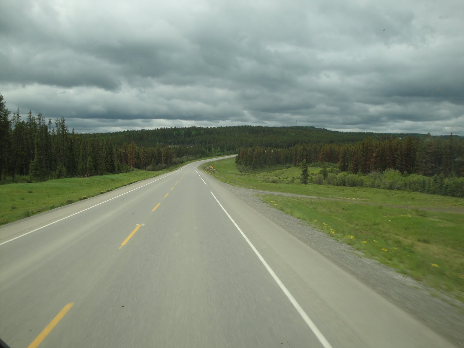
After we left the Alaska Highway, we continued on the Richardson Hwy, along the broad Tanana River valley, northwest toward Fairbanks. To our left were the peaks of the Alaska Range

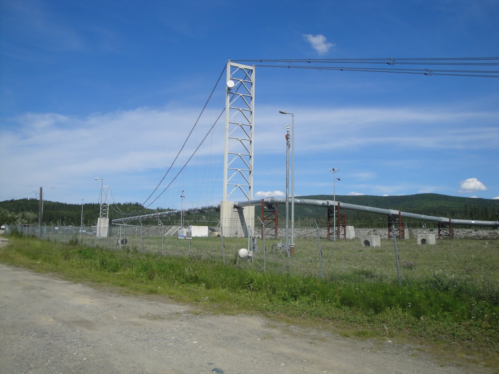
Just up the road a short ways we found 2 interesting stops, almost together: Rika’s Roadhouse and the famous oil pipeline.  Very interesting history of both, but I won't add it here.


It was a gorgeous day, with the temps hitting 89 in Fairbanks (can you believe it?)

We plan to spend a couple of days around here, since there is lots to see and do. This will be as far north as we get: 64.8 degrees N = 64degrees - 48’. This is about 3 degrees further north than Valentina’s other grandparents and also farther than our friends in Norway.

Since we are now past the summer solstice, the days are already getting shorter. If I can believe my old Garmin GPS, sunrise is at 3:01AM and sunset is at 12:43AM for 21hrs 42 min of daylight (90%) . This is shorter than it was just a few days ago.  The lack of darkness hasn’t kept either of us from sleeping our usual 7 to 8 hrs/night.

I forgot to mention the longest day, when we were back in Dawson, and what some other people were doing. Some of the Newmar owners we met the past few days had a golfing tee time at midnight, and some local Dawson people held an overnight party at the top of the nearby Midnight Dome.  We drove up there in the car, but didn't stay for the party.

Friday, June 24, 2011

Another Day Off

Today’s details have to start with late yesterday. We are staying at the Sourdough Campground in Tok AK and their “claim to fame” is the pancake toss held every evening at 7:00PM. It is a fun mixer to bring fellow travelers together and socialize. Anyone who wants gets 2 opportunities to toss an old pancake into a 5 gal bucket about 20 ft away. If they are willing to sing a song, they can have a 3rd chance. Winners get a free breakfast the next morning. While a lot of joking goes on there weren’t a whole lot of winners and I think there was only one case of both husband and wife winning – that was US last night so our morning started off great! And neither of us had to sing.


Since our mail had not arrived as of yesterday, we planned to take it easy today and check back at the Post Office this afternoon. We took the opportunity to do our laundry and do some extra reading.

We also washed the car again; we will wash the motorhome as we leave tomorrow. Our mail still hadn’t come in as of today, so I filled out a card to have it forwarded to Paige’s Uncle Phil. We will be at his place in about 5 or 6 days, after North Pole, Fairbanks, and Denali Park.

Phil had suggested a local restaurant to us, and we’ve just returned. The appetizer plate of breaded mushrooms that Phil recommended was HUGE. We shared with a number of our campground neighbors who also happened to be here tonight.
As long as someone has asked for our weather observations, others might be interested too, so here is what we’ve been seeing. The past few days have generally been quite cloudy with scattered sprinkles. As we were pulling off the road 2 days ago, the skies opened up and dumped a lot of water in a short time, which made the dismal Taylor/Top of the World combination dangerous as well as miserable. Sprinkles kept the dust down, but heavy rain means soft, slick mud all over everything. Yesterday had heavy cloud cover without a lot more rain, and temps in the mid 50s. The members of a Newmar caravan, who pulled in here yesterday, said it was too foggy for them to see anything but the mud and potholes. There is a reason that Tok is said to be the RV Wash capital of Alaska.

Today, on the other hand, was gorgeous with a clear sky and temps close to 70. Not far south of us, we can see the tops of the Wrangell Mountains which stretch for over 150 wilderness miles to the Gulf of Alaska

Tomorrow's forecast is for temps near 80.

Thursday, June 23, 2011

Civilization Again

We have made it off the Taylor/Top of World Highways and back to the Alaska Highway. It has a 55 mph speed limit and can actually be driven at this speed. Even better, both of our cell phones work once again (first time in over 2 weeks). We made a planned stop in the town of Tok, where our mail is going to be delivered. It isn’t here yet, so we will be staying at least one more night before moving on to Fairbanks.

We haven’t taken any pictures, so this will be a short posting. I have updated the map for the past couple of days. If you click on the map, you can shift it around and change the level of magnification.

Other than the post office, we did visit a couple of gift shops, a grocery store and a liquor store. Now that we are back in the USA, we certainly appreciate the lower costs of everything (plus the fact that Alaska has no sales tax).

“Back in the USA”

Notes for Wednesday June 22:

Tuesday was a lot of miles, and today was planned to be much shorter so we slept in and had a larger than normal breakfast. Outside of town the last dredge (machine used for mining gold) in the area has been turned into a park with guided tours


Dawson has a lot of touristy things for some people, but we are not shoppers so we packed up and headed for the ferry which we needed to take to get to our next highway.
Across the river the road is known as “Top of the World” since it climbs above the tree line and has a lot of scenic views. Here are a couple of views from the Canadian side

The guidebooks have lots of comments about Top of the World, and the road and views aren’t bad (on the Canadian side). We crossed the border about 2 hours after we got off the ferry

We have met a lot of interesting travelers so far; some from Germany and France as well as Canadians and others from the lower 48. This is a very international trip. The road down from the border to Chicken AK is an abomination. The State of Alaska should be ashamed, as an American I was embarrassed for the European visitors. This is the same area, climate, and conditions but the Canadians provide us with a usable road. The US side is worse than a typical truck stop!! The 42 miles from the border to Chicken AK took 3 hours.  Typically it is narrow, soft if rainy (like this week), no shoulders, and heavily potholed.

Many recommend the combination of Klondike/Top of the World Highways as an alternative to the Alaska Highway, but we both agree the scenery wasn’t worth it.

I just had to get this rant off.

Tuesday, June 21, 2011

Long Day - short Posting

We detoured off of the Alaska Highway, to take the Klondike loop to Dawson YT.  It was about 300 miles and took 8 hrs.  The RV park here has some limits on internet use, so we will save pictures for another day.
Tomorrow we will decide if we stay here for a day's catchup, or take the ferry across the Yukon River to Chicken Alaska on the "Top of the World Highway" and back to the Alaska Highway from there.

We will post more later

A Day off in Whitehorse

Here is how we celebrated a non-driving day:

We started with a hike at Miles Canyon, which was a major challenge to the gold miners traveling through this area to get to the gold fields near Dawson and for Paige (she doesn’t like heights!). Not a long hike, just enough to see the gorgeous river color.


Then we went downtown for some coffee, shopping, sightseeing, and touristy stuff.
Sightseeing included the log “skyscraper”

Touristy was taking a guided tour of the “SS Klondike” which is a National Historic Site
Also “touristy” was seeing the worlds largest weathervane”
This DC3 pivots with the wind direction and always faces into the wind.

We finished the day by catching a vaudeville show at a hotel downtown. The Fabulous Follies was like an 1890s version of “Laugh In” with CanCan dancers. They used a couple of members of the audience for fun (thankfully neither of us).
Tomorrow will be a longer than normal driving day to get to Dawson City.  Hopefully we can get Internet access there as well.

Sunday, June 19, 2011

We’re In a Big City!

Around noon today we arrived in Whitehorse, the capital of Yukon. We’re at a campground where we parked on a gravel surface; no grass in this campground. However, they do have an RV/Car wash which we made use of right away.
Those of us going north are dirty from some small gravel patches. Those coming south are DIRTY! It’s amazing how dirty the RV and car can get. Apparently there is a huge stretch (around 150 miles) of gravel road coming up for us. The motorhome tires throw rocks and dirt on the Saturn. We’ve already got a cracked windshield and another chip in the windshield. We’ll get them replaced when we get back in MN.

Happy Father’s Day to all those guys out there! Paige took the big step and called her Dad for Father’s Day and David who will be celebrating his 40th birthday tomorrow. It was so good to talk to family after being out of touch since we got in Canada 2 weeks ago. Once we get to Alaska communication should be easier.

We only had a 100 mile trip today and there were just two stops. The first was at a bakery right after we crossed the Teslin River Bridge (3rd longest span on this highway). Our second stop was at a bridge and dam over the Yukon River.


Because this is the biggest town we’ve been in since Edmonton last week, we took the opportunity to get provisions (aka groceries). They have 2 grocery stores in town (although it looked like one was closed). And we stopped at the Visitors Center to gather some information for tomorrow.

Tomorrow we’ll be staying here so we’ll be doing some tourist stuff in Whitehorse. Also, they have a Tim Horton’s!! We’re going to see a play – Frantic Follies – that sounds pretty fun. Also, they have a yarn shop here – yippee!

Fun fact – sunrise here is at 6:28 a.m.; sunset is at 1:34 a.m. This is 19 hours and 6 minutes of daylight.

Saturday, June 18, 2011

Across the (Sub)Continental Divide

I have just noticed our dates have been off a little.  Today is Saturday June 18.
Yesterday's Sign Forest in Watson Lake was posted late Friday, the 17th and the one before that was from the 16th but also posted on the 17th since we didn't have connection at the Hot Springs.

I hope that clears things up.....

We had another comfortable (short) day. After a leisurely start, we took a short walk to view the waterfalls at Rancheria Falls. They had a pleasant boardwalk to get us there.


Cloudy skies with a rare sprinkle kept the wildlife sightings down to a minimum; just one adult fox with kit. After the waterfall, we came to a Continental Divide at a fairly low elevation. The streams behind us (to the East) all combine to flow to the north and the Arctic Ocean (also called the Beaufort Sea); those we are about to come to all combine to flow around Fairbanks to the northwest and the Bearing Sea (then to the Pacific).


We stopped by midafternoon at Teslin, where the town and our campground are both just across this bridge (which is the longest of all bridges on the Alaska Highway).


Quiz time for our readers: What is the capital city of the Yukon Territory? (answer tomorrow)

Seeing a Sign Forest

Today was a short day, mileage wise, so we took extra time at the Hot Springs for a morning soak. Then we were back on the Alaska Highway on our way to Yukon Territory. The border is 60 degrees North latitude, which we crossed about noon.

The town of Watson Lake is known for its Sign Forest, something we’ve heard of, but really must be seen to be believed. There are now over 75,000 signs here which all started with a soldier who put up his hometown’s name back in 1942. These signs are put up by folks on their way to or from Alaska for the most part. We saw signs from many cities in Minnesota, Mukwonago, WI, Germany, Pakistan, and many others.

We also took some time to see a presentation at the Northern Lights Planetarium across the street from the signs. There were 2 presentations; one of the preparation for NASA astronauts and the second was video of the Northern Lights. Let me just say that I had to nudge Bob a couple of times and when we were leaving other wives were making comments to their husbands also. It was not the most interesting presentation we’ve seen.

Friday, June 17, 2011

"Off the Grid” Tonight

(This post is from yesterday - 6/16 due to no wifi)

We had a nice sunny day for driving.

We stopped for a morning treat at the Testa River Services which claims to be “the Cinnamom Bun Center of the Galactic Cluster. We decided not to wait their 30-40 minutes for the next batch, even though they are the size of salad plates. Instead we finished off some day (or two) old Tim Bits.

Today we saw bears, mountain sheep, buffalo (a herd of them), and rabbits. Here are some of the pictures we got.  A herd of buffalo was just laying along the highway here.

Mountain sheep below

We pulled into the Liard River Hotsprings Provincial Park around 2:30. It was still sunny and 75 degrees so we decided to walk to the hot springs and experience those. It was a nice walk. The hot springs smelled a bit of the sulfur and Paige didn’t like that smell. But we both went in the springs and enjoyed the warm, relaxing water.
We spent the later afternoon and evening at the motorhome just relaxing. Rain started about 6 and has continued. At this campground in the mountains, we have no TV, radio, electricity, or water. No cell phones or Internet either, so we’re forced to have a quiet evening and have been reading our Nooks.

Wednesday, June 15, 2011

We Saw Animals!

Shortly after we left Dawson City this morning, we had a chance to leave today’s main highway and drive a little of the original road. The reason for this detour is the chance to cross the historic curved wooden Kiskatinaw River Bridge. It is the only original timber bridge on this road that is still in use. Here are our first couple of views


And looking back after we’d crossed it


We’ve seen signs for Moose and Deer along the route but we were beginning to think they were just there for the tourist draw. Today we drove from Dawson Creek to Ft. Nelson which was a hillier, scenic drive – aside from the periodic rains! First Paige saw a deer standing in a field. Then she got a glimpse of a mama and baby bear walking along the tree line next to the highway. Right after that we could see something by the tree line ahead of us which was brown. Turned out to be a moose and it started running along the grass by the highway. Pretty neat! So, we now believe there really are animals up here.

By mid-morning we could see some mountains off to the west, but we did not get into them. This road skirts the edges as much as it can. Here is a typical view:


It was cloudy all day with scattered showers that ranged from annoying mist almost to rain, and back to cloudy again. The car and motorhome are both quite dirty.

At our campground tonight, we only get one station. Guess what’s on?? The 7th game of the Stanley Cup. Today at our daily Tim Horton’s stop, we saw that they’ve renamed the “Boston Cream Donut” to the “Vancouver Cream Donut”. Everyone’s really crazy here about this hockey game. The campground has a small bar with a large screen TV and they’ve invited everyone over to watch the game.

Most of British Columbia is on Pacific Time (except here), and most of Canada follows Daylight Savings Time (except here). Is this confusing, or what? Since we are further west than Seattle, it is time to change our clocks to Pacific Daylight Time until we get to Alaska, which is another time zone.

Tourist Day in Dawson Creek

Paige is writing today’s blog. I’ve recovered from yesterday’s illness. Whatever it was, it was AWFUL! I pretty much slept the whole day and suffered from aches and chills. Today, however, I woke up feeling mostly back to normal. Yippee, because we planned on playing tourist today.
We started the day with a stop for coffee at Tim Horton’s (found out that Tim Horton was a former hockey player who apparently passed away some time ago). We then hit the museum and walked around the town.
Look at the white sign above the right window.


One museum showed a documentary about the creation of the
Alaskan Highway
which was very informative: the entire road was done in less than a year, during 1942.  It was a war effort, which was begun shortly after Pearl Harbor was attacked.


Because we are in British Columbia, we are caught up in the media hype for the hockey Stanley Cup Playoffs which has the Vancouver Canucks battling the Boston Bruins.  Game 7, the final game, will be played tomorrow night.  Probably 75% of any news program focuses on this game.  We found this sign on a business today:
By way of explanation, Boston Pizza is a large chain  throughout the country, and they are modifying their own signs to support a Canadian victory over a US team.

Monday, June 13, 2011

Cooling it at Mile Zero

After 8 days on the road (1,671 miles from the cabin) we have just arrived in Dawson Creek, British Columbia at the closest end of the Alaska (formerly Alcan) Highway. This puts us a little over halfway to Tok, AK which is the first good sized town into Alaska (and where we plan to get our mail late next week).

We expect the roads to get narrower, slower, and rougher so we are planning more days and shorter drives per day until Tok. There will also be lots more touristy things to see, and more wildlife too. This beaver doesn't move around at all:


Western Alberta has a lot of forest cover and became rolling hills, but still no mountains in sight. Just playing with map coordinates, I see that we are West of Los Angeles, and farther North than most of Europe.


Bob is just now getting over a summer cold, but it hit Paige pretty hard yesterday and today, so this is another reason to slow down and shake it off.