Wednesday, October 30, 2013

Central Oregon

It is hard to believe how quickly the time goes by.  Especially when it seems like we have not been too busy.  So, what have we been up to?

We had the opportunity to stay at Tumalo State Park just one more day after our last posting, since the place was totally reserved for the weekend.  Last Thursday was a quiet day we spent shopping in Bend.  Since we will be on our feet a lot while we are at Amazon, we both got some good shoes (aka $$$$) with lots of support.  We will be breaking them in over the next few days.

Friday was a “Moving Day”; back across the Cascade Range to the central valley.  Once again we noticed the dramatic climate change from the high desert of Bend and Sisters to heavily forested mountains in just a couple of miles.  The route we used was not the shortest one, since Oregon State Hwy 242 is closed to anything our length because it is so twisty.  Sometime we’d like to come back and ride it on the motorcycle (in warmer weather).  We connected with Interstate 5 near Eugene and drove it for more than 50 miles (the most Interstate driving we have done since late August).  We got off the road at Sutherlin, where the Escapees have another of their co-op parks. 

The weekend was a quiet one.  We try to avoid the grocery stores and touristy things on weekends so that working people with families can use them.  Instead, we spent our weekend doing laundry and going for walks around the park.  We also attended the Methodist Church in Sutherlin.  This was a unique experience – there were 9 people, total, in the church including the minister and organist.  They were a very friendly group that invited us down for a small lunch after church.  Almost every one of them had some connection to Minnesota so conversation was lively.

After the weekend, it was back to being touristy once 
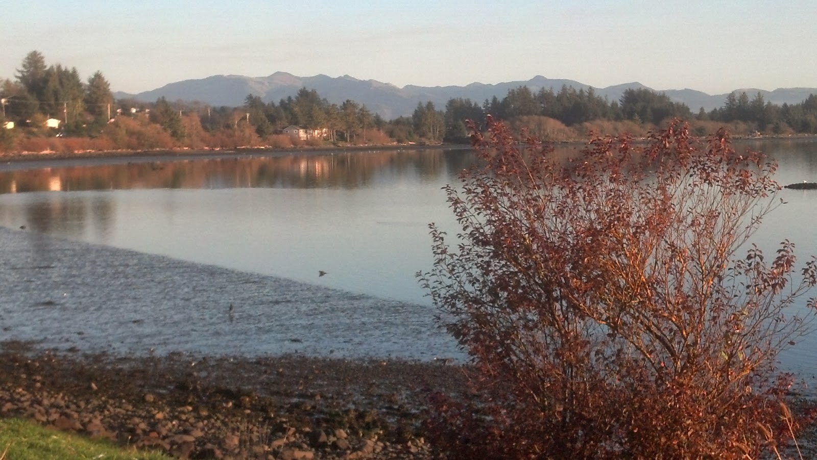
again.  Monday we went back to the Pacific coast, from Florence down to Reedsport.  Florence has an area called “Old Town” under the US Highway 101 bridge.  It has lots of restaurants and shops.  We stopped at a little restaurant on the corner where we came into town.  Paige had the best ever “crab melt” sandwich!!
  
Tuesday was a much longer driving day.  We went to Crater Lake National Park. 


This is visually spectacular, but it is a long drive from anywhere.  At 1,943 feet this is the deepest lake in the United States and was formed in a very short time when a volcanic mountain collapsed.  For details see http://www.nps.gov/crla/index.htm  

Much of the park is closed for the winter, but the southern entrance and the Visitors Center are open all year.  The parking lot is ready for the snowplows.
The reason for the tall snow poles is that they normally get about 44 feet of snow here during a typical winter.  The water in the lake comes from snowmelt and rainfall.  There are no rivers or streams flowing in OR out of this lake so the water stays very pure.


Today we’re going to do a tour of local wineries.  There are many wineries around here so we need to do a little tasting.  Also, today is flu shot day for us.  Want to get that done before flu season arrives.

Thursday, October 24, 2013

Northen Oregon

As we had planned, Saturday was spent playing tourist at the Tillamook County Cheese plant:
We got an overview of their importance in the community and had lots of samples of their cheeses and their ice cream.  We took the time to chat with the owner of the RV park, who suggested a couple of local churches for us, and talked with her maintenance man, Charlie, who suggested a number of restaurants and scenic areas.

On Sunday we skipped breakfast in order to have a brunch after an early church service.  By chance, Charlie happened to come into the same café shortly after us, so we had him sit with us.  He has a ton of information on the local scene as he’s lived in the area his whole life.  Here  is the entrance to the bay


Monday was our chance to take a motorcycle ride through the twisty roads of the Coastal Range.  State Highway 22 was a pleasant roller coaster of a road through the trees.  We went to McMinnville where Howard Hughes’ wooden airplane, the Spruce Goose, is on display.  We found the display area, but were too cheap to justify the admission charge and it was too late in the day, so we came back the same way.  It was a nice day for a ride in the woods.  Then it was back to the cheese plant for purchases:

Tuesday was a travel day; a little over 200 miles from the Pacific coast, over the Coastal Range, across the broad Willamette River valley, over the Cascade Mountains to the high desert area of central Oregon.  The Presidential Range (Mounts Washington and Jefferson) were much less spectacular than snow-covered Mt. Hood.  We came through the touristy town of Sisters, to a small state park near Tumalo.  After setting up our campsite we had birthday dinner (guess who) in Bend at Applebee’s.

We had visitors from eastern Oregon today.  Carl and Ronda came from about 3 hours away to spend the afternoon with us.  We have known Carl since the late 60’s when he was a new customer engineer for Control Data, and Bob was still in college.  We had a lot of catching up to do since they last stopped in to see us about 15 years ago.  We introduced them to geocaching this afternoon when we found 2 caches hidden nearby:


They had to return to their home this evening in order to meet with some kids in a Head Start program in the morning.  They are on the local fire department in their city, John Day, and will be educating the 4 year olds in fire safety.

Saturday, October 19, 2013

Into Oregon

Last Thursday was a day filled with starts and stops; many attempted travel plans along with as many revisions.  The first big “plan changer” was the lack of hot water this morning.  We had plenty of hot water last night, but none this morning.  Our water heater can be run on either electricity or propane, but neither would heat our water today.  We left a voice-mail for a local RV service agency and waited.  After an hour or two without a response, we found an alternate service group that might be able to inspect our system within 2 days and plan a repair later.  While setting an appointment for this second choice, the first one called back.  He was a mobile service and came right to our door.  His diagnosis was spot-on, and he had the repair part we needed on board his truck.  We were fixed by 1:00 PM but had lost a good part of the day. 

We chose to use the rest of the day to pick up our mail which was being held for us at a post office alongside Interstate 5, near Mt St Helens.  Both Microsoft and Garmin suggested we cross the Columbia River into Oregon and take US30 to the Interstate, then cross the river again, back into Washington.  Crossing the Columbia near its mouth means using the Astoria Bridge.  Here is the lower, northern, end:

 
The southern end rises high enough to allow ocean-going ships to pass underneath.  Just our luck, it was down to a single lane for repairs so we had the chance to park near the highest part and wait our turn to use it.  For Bob’s traveling, Oregon is the 49th state he has been in.  Only Hawaii remains, and the bridge there hasn’t been scheduled for construction yet. 

We again crossed the river at Longview Washington and joined Interstate 5 for about 10 miles.  This was the first official Interstate travel since we left Minnesota over 2,000 miles ago.  After picking up our mail, we went to the Mt St Helens Visitors Center which is run by the state of Washington.  We got there 30 minutes before it closed, and the national Seniors Pass isn’t accepted here.  The National Park visitors center was another 45 miles away.  This view is as close as we got:

We returned to the motorhome, back on the coast, by using Washington highway #4 which was a very pleasant alternative to US30.

Before leaving the Long Beach peninsula yesterday, we explored the north end and found the Ocean Park Retreat Center.  This church camp has often hosted Nomads groups but their scheduled project for 2013 didn’t happen due to lack of volunteers.  It sure looked like a nice place to work in the future. 

On Friday we both received our formal confirmations from Amazon that we have been scheduled for the same day shifts starting November 12 so we are now committed to manual labor: four 10-hour days per week for 6 weeks.  This should help pay for the water heater service and the new satellite TV system.  We can play tourist for another 3 weeks, then report for duty.

Once again we crossed the Columbia River into Astoria, then continued south on US101.  Here is a view of the shoreline we had during a lunch stop.
 
We stopped for the night between Bay City and Tillamook. We found a seafood-fix for dinner at the Fish Peddler which is part of Pacific Oyster Co.   It’s right on the ocean and you can watch them clean oysters and clams while you eat.

Plans for today include sampling cheese and ice cream at the Tillamook Cheese Company plant nearby.

Thursday, October 17, 2013

Along the Pacific

Our last full day on the Olympic peninsula was Sunday.  It began with a local church service in Chimacum.  We went with the Fords, another couple who are also NOMADS and also members of Escapees.  They have their own lot here at the RV park. After that we had a HUGE breakfast at the local café and got to know them a little better.  They have worked a lot of projects, mostly in the west, and we found that we have worked with many of the same people at different times.

On Monday we pulled out and headed south, stopping for a scenic view of the Hood Canal from the top of Mt. Walker.  We have no pictures to show, because the lower elevations were fogged in.  Our destination was the Long Beach peninsula in the SW corner of Washington, jutting into the Pacific Ocean and just north of the Columbia River.  This is where Lewis and Clark ended their western exploration and spent the winter of 1805.  We found many RV parks throughout the communities on this point, but selected Sand Castle RV since it honors Passport America membership.  The drive here was through some Weyerhauser land where lumber is the primary crop.  One area in particular was hit hard by hurricane force winds in 2007 that took down hundreds of acres of trees.  It was harvested like a clear cut and replanted.  Again, no photos, but the size of some of the stumps was amazing.

Yesterday we back tracked a bit to the town of Aberdeen to have a couple of drug tests.  We have been unable to find any NOMADs projects here in the west for the remainder of the year, so we have contacted Amazon to work in one of their warehouses (“fulfillment center”) until Christmas.  If they can promise us day shifts, and if we pass the drug tests, we will spend November and December in Fernley, NV.

We plan to meet up with some friends in Oregon later in the week, so a good part of last night was spent studying the maps and calendar and planning our short term schedule.  The result was that we will stay here a little longer, so we spent this morning cleaning – not just our usual top to bottom 15 minutes, but really cleaning a lot, maybe 45 minutes.

To make up for the lack of earlier photos, here is one from one of our walks on the beach tonight:


Sunday, October 13, 2013

On the Olympic Peninsula

Friday’s trip along the northern shore of the peninsula changed a little along the way.  We got off the main road and took a number of back roads along Sequim (pronounced “skwim”) Bay to the Dungeness Spit, which is a shallow sand bar into the Strait of Juan de Fuca. The Sequim area is known for its production of lavender.  We stopped at a small farm to see how they process this herb.

We got to Port Angeles about mid-day, but then learned their crabfest wouldn’t begin until 4PM.  Oh well, the Thai food was almost as good.  Hurricane Ridge is part of the Olympic National Park, and is just outside of town but the ridge was fogged in and the Visitors’ Center was closed due to the government shutdown.  Instead, we went a little farther west and found a back road along Lake Crescent that was similar to some NASTE motorcycling routes back home.

Here is where we turned back

 
Saturday, we stayed a little closer to home by first finding a couple of local geocaches, then wandering along the shoreline of Puget Sound, from Port Ludlow, to Mat Mat Bay, to Marrowstone Island, to Port Hadlock.


We didn’t take the time to check out the beaches, but we did stop to get some fresh crabmeat and other seafood at a couple of  local shops.

Thursday, October 10, 2013

Staying Busy in Washington

On Tuesday afternoon, we went over to Whidbey Island to see Paige’s cousin, Dianne.  We also got to meet her son, Dillon.  She has a wonderful house right on Useless Bay so we went for a short walk down the shore.
 
We were surprised at how big this island is!  It is the 4th largest island in the lower 48 states, being about 35 miles long by 1-1/2 to 12 miles wide.  We went out for supper and then headed home.  Dianne is getting ready to go back to work in the Arctic for the winter.  She’s a busy person!

Yesterday we bit the bullet and bought this little guy:
 
This is the satellite receiver called “Tailgater” that gets us access to Dish TV.  We’ve debated about going this route in the past, but we don’t have any access to TV here, even though we’re close to Seattle.  We can also use this at the cabin in the summer.  So, life is good here now that we can watch our shows.  Paige wasn’t happy that she missed Dancing With the Stars this week.

After Dish was set up, we went to Port Townsend for the afternoon.  A real nice little city on the ocean with TWO yarn stores!  We also stopped at a coffee shop and enjoyed watching the ocean.

 
Today we took a trip into the big city, Seattle.  We’ve always heard about Pike Place Fish Market in our working life as they have motivational tapes used in corporations.  So we went there and it was nice to see – but overpriced.  So we walked around all the shops and drove by the Space Needle and then headed back home.
 
Going to Whidbey Island and Seattle both required round trip ferry rides.  Those can sure run up the expense of an outing.  We were planning on going to Victoria and/or Vancouver in British Columbia but both of those trips require coming and going on even longer ferry trips, so we’ve decided to stay on the Olympic peninsula tomorrow and check out some wineries and scenic stops around here, plus the Dungeness Crab Festival in nearby Port Angeles.

Tuesday, October 8, 2013

After Three Days on the Road, Time to Park It

Over the past couple of days we crossed the state of Washington on State Route #20 – about as close to the Canadian border as possible.  We wanted to see the North Cascades National Park, but like most federal facilities, the visitors’ center was closed.
 

As planned, we crossed Interstate 5 into western Washington by mid-day on Monday.  Here is the bridge at Deception Pass which we are about to cross – from the mainland onto Whidbey Island. 

This island is much larger than we had expected.  After crossing the island, and traveling half its length, we left the island on the 3:00PM Port Townsend Ferry over to the Olympic peninsula. 

  We had the best view on the ferry.

We have parked for the next week at the Escapees co-op park at Chimacum, WA.  As we walked around the park we met another couple who volunteer with Nomads, the Fords, who own a lot here.  We have not worked with them, but we know many of the same people.  It’s a small world.
 
As we travel, we learn about regional favorites.  From Flathead Lake and west, we’ve been able to taste everything huckleberry – huckleberry cream cheesecake (VERY yummy!), coffee, syrup, ice cream (made by local Tillamook – again, yummy!), brownies, and candy.  It is wonderful! 
Now we’re hoping that we can get some good seafood, since we’re along the coast again. 

Today we’ll be going to visit Paige’s cousin, Dianne, before she leaves tomorrow for her job in the Arctic Circle.  She lives on Whitbey Island so we’re going over on the ferry to see her and have dinner somewhere. 

Today we may join the 21st century and get satellite TV.  There is absolutely no local TV access here even thought we are not far from Seattle.  We have a technician coming out this morning to explain the options.  We’ll see….


Sunday, October 6, 2013

Again on the Road

Saturday, we left Montana’s Flathead Valley traveling west across the Cabinet Mountains and along the Clark Fork River to Lake Pend Oreille.  We spent the night in the panhandle area of Idaho, at the Bonner County Fairgrounds, with only one other rig.  Our only neighbors were the couple who do the camp hosting. 

Sunday was chock full of Ups and Downs:
            North along the Pend Oreille River
                        West, up and over the Selkirk Mts
           Down to the Columbia River, crossing at Kettle Falls
                        West, up again over the Sherman Pass through the Kettle River Range
            Down again to Sanpoil River
                        West, and up again, over Wauconda Summit
            Down again to Okanogan River
                        Yet another “up” over Loup Loup Summit
            Down to the Methow River
Whew!

 
With all these rises and falls, I will be curious to check our fuel usage at the next fill up.  I really appreciate the diesel’s exhaust brake, but could use a few more Hp.

We stopped for the night alongside of the Methow River as we are moving toward North Cascades National Park.
 
We expect to arrive in the Seattle area by mid-afternoon tomorrow.  Then we will park it for awhile.

Friday, October 4, 2013

Time is Up

Our 3 weeks on Flathead Lake has come to an end.  We had our “Goodbye Banquet” last evening and half of our group is already gone.  One couple has gone north to Canada for some sightseeing, and another rig is going south to the hot air balloon festival in New Mexico.   Another couple has stayed here one more night, as have we, to pack up tools and do laundry.   

Today was a beautiful, sunny day.  We took the opportunity to take a couple pictures of the camp before we leave this great place. 


This afternoon we drove to the top of Blacktail Mountain to get an overview of the Flathead Valley.  In about 13 miles, we climbed about 3800 feet in altitude, and dropped about 10 degrees in temperature, but the views were terrific.  We could see the mountains across with snow topped peaks across the lake.  We hope photos do it justice.


Tomorrow we leave for the west.  Since the weather has been clearing, we plan to go into Idaho and then take the northern route, state highway 20, across Washington through North Cascades.  We expect more spectacular scenery.